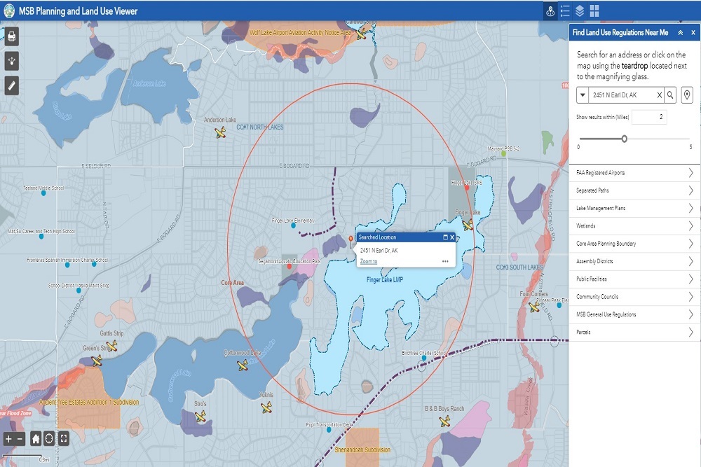
Curious about land use regulations near you? Check out the new tool our Planning & GIS teams have been working on!
The Planning and Land Use Viewer allows the public to view MSB planning and land use regulations in one easy-to-use location, showing Special Use Districts, Lake Management Plans, and other Borough regulated areas. It provides a web link directly to relevant information or Borough code and will be especially beneficial for anyone developing or purchasing land in the Borough.
*The map is designed for informational purposes only, and it is the user's responsibility to identify and adhere to all appropriate regulations.
Original source can be found here.

 Alerts Sign-up